Expert My Boundary Dispute Surveyors Resolving Property Boundary Issues

Are you facing a boundary dispute with your neighbour? Our RICS-accredited chartered land surveyors provide expert boundary surveys and reports to help resolve property boundary issues quickly and professionally. We work across England and Wales to determine the exact location of your boundary.

RICS Accredited
CIOB Certified
RPSA Members

Request Your Boundary Survey

Fill out the form below and our experienced surveyors will contact you within 24 hours.

500+

Boundary Disputes Resolved

98%

Client Satisfaction Rate

25+

Years Combined Experience

100%

RICS Accredited Team

Our Boundary Dispute Survey Services

Expert boundary surveys from chartered land surveyors to resolve your property boundary disputes

Boundary Survey

Detailed measured surveys to determine the exact position of your boundary using Ordnance Survey mapping and Land Registry title plans. Our topographic surveys identify boundary features on the ground.

Learn More

Boundary Dispute Resolution

Professional boundary reports to help you reach an agreement with your neighbour and resolve boundary disputes without costly legal action. We provide expert witness services for solicitors.

Learn More

Land Registry Services

We help you understand the general boundaries rule and apply for a determined boundary with HM Land Registry. Our chartered surveyors interpret title plans and property deeds accurately.

Learn More

Property Purchase Surveys

Topographical surveys for property buyers to identify potential boundary issues before purchase. We work alongside conveyancing solicitors to ensure registered titles are accurate.

Learn More

How We Resolve Boundary Disputes

Our proven four-step process to help you understand the position of your boundary

1

Initial Consultation

Contact us to discuss your boundary dispute. We'll review your title plan, Land Registry information, and any historic boundary features to understand the boundary position.

2

Site Survey

Our chartered land surveyor visits your property to conduct a detailed measured survey using Ordnance Survey mapping. We identify fence lines, hedges, and physical boundaries.

3

Expert Analysis

We analyze all evidence including conveyance documents, title deeds, OS mapping, and features on the ground to determine where the boundary lies according to the general boundaries rule.

4

Boundary Report

You receive a comprehensive boundary report with our findings and recommendations. This helps you reach an agreement with your neighbour or provides evidence for the boundary determination process.

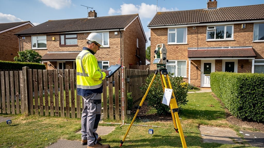
Why Choose My Boundary Dispute Surveyors?

When a boundary dispute occurs, you need experienced surveyors who understand the complexities of Land Registry title plans, the general boundaries rule, and how to resolve boundary disputes efficiently.

  • RICS Chartered Surveyors

    All our boundary surveyors are registered with the Royal Institution of Chartered Surveyors and follow their strict code of conduct.

  • Local Knowledge

    We operate across England and Wales, with deep understanding of local Land Registry practices and Ordnance Survey mapping variations.

  • Cost-Effective Solutions

    We help you resolve the dispute without costly legal action. Our boundary reports are useful to identify issues early and reach an agreed boundary.

  • Expert Witness Services

    If legal action is necessary, our chartered land surveyors provide expert witness testimony to support your case with detailed boundary surveys.

RICS chartered surveyor conducting boundary survey on property

What Our Clients Say

Real testimonials from property owners we've helped resolve boundary disputes

"We had a longstanding boundary dispute with our neighbour over a fence line. My Boundary Dispute Surveyors came out, conducted a thorough topographical survey, and produced a clear boundary report that helped us reach an agreement without going to court. Their chartered surveyor was professional and knowledgeable about Land Registry procedures."

Sarah Mitchell Homeowner, Manchester

"Excellent service from start to finish. We were buying a property and noticed the title plan didn't match the physical boundaries on the ground. The team quickly identified the boundary issues using Ordnance Survey mapping and helped us understand the position before we completed the purchase. Highly recommend their boundary survey service."

James Robertson Property Buyer, Birmingham

"As a solicitor, I regularly instruct My Boundary Dispute Surveyors for complex boundary disputes. Their RICS-accredited surveyors provide detailed boundary reports that are invaluable in helping clients resolve disputes. They understand the general boundaries rule and the Land Registry determination process thoroughly."

Amanda Thompson Conveyancing Solicitor, London

"We had a boundary dispute over a hedge that had been in place for decades. The surveyor explained how historic boundaries work and used old Ordnance Survey maps alongside the current title deeds to determine where the boundary lies. Their measured survey was exact and helped us avoid costly legal action."

David Palmer Homeowner, Bristol

"The team helped us with a boundary agreement that's now registered with HM Land Registry. They explained that title plans do not show exact boundaries under the general boundaries rule, but their detailed topographic survey provided the evidence we needed to apply for a determined boundary. Outstanding service!"

Emma Williams Homeowner, Leeds

"Professional, reliable, and incredibly knowledgeable. Our boundary dispute was complex involving rights of way and overlapping title plans. The chartered land surveyor provided expert legal advice alongside the survey work and helped us resolve the issue without going through expensive court proceedings. Five stars!"

Michael Chen Property Developer, Liverpool

Frequently Asked Questions

Common questions about boundary disputes, surveys, and the Land Registry

A boundary dispute occurs when property owners disagree about where the boundary line between their properties lies. This often happens because Land Registry title plans do not show exact boundaries due to the general boundaries rule. Disputes may arise over fence positions, hedge lines, or when physical boundaries on the ground don't match the title plan. Common triggers include property purchase, fence replacement, or building extensions near the boundary.

A chartered land surveyor conducts a detailed measured survey using Ordnance Survey mapping, examines your Land Registry title plan and title deeds, and analyzes boundary features on the ground. They produce a comprehensive boundary report showing where the boundary lies based on all available evidence. This expert analysis helps you understand the position of your boundary and provides a factual basis to reach an agreement with your neighbour, often resolving the dispute without costly legal action.

The general boundaries rule is a fundamental principle used by HM Land Registry. It means that title plans show the general position of boundaries, not their exact legal location. Plans do not show exact boundaries because the red line on a title plan is typically drawn at a scale where one millimeter represents several meters on the ground. This is why boundary disputes occur - the actual boundary position may be uncertain. To establish exact boundaries, you need to apply for a determined boundary through the Land Registry determination process.

Yes! Most boundary disputes can be resolved without costly legal action. A professional boundary survey from RICS-accredited surveyors provides an objective assessment of where the boundary lies. This boundary report is useful to identify the correct boundary position and helps both parties understand the situation. Many neighbours reach an agreed boundary after seeing professional survey evidence. You can then register this boundary agreement with HM Land Registry, avoiding court proceedings entirely.

A topographical survey maps all physical features on a property including buildings, fences, trees, and ground levels. A boundary survey specifically focuses on determining the legal position of property boundaries by analyzing title deeds, Land Registry information, historic boundary documents, and Ordnance Survey mapping. For boundary disputes, you typically need a specialist boundary survey that examines legal documentation alongside the physical features. Our experienced surveyors combine both approaches to provide comprehensive boundary reports for dispute resolution.

The site visit for a measured survey typically takes 2-4 hours depending on property size. However, the complete boundary survey process includes reviewing Land Registry title plans, property deeds, historic maps, and conveyance documents, which takes additional time. Most clients receive their comprehensive boundary report within 10-14 working days of the site visit. For urgent cases involving property purchase or legal deadlines, we can provide expedited service. Contact us to discuss your specific timeline requirements.

Please provide your Land Registry title plan and title deeds (you can download these from HM Land Registry), your property address, details of the boundary dispute including which boundary is in question, and any correspondence with your neighbour or solicitor about the issue. If you have historic documents like old conveyance deeds or previous surveys, these are very useful to identify the historic boundary position. Our chartered surveyors may request additional Land Registry information during the investigation if needed.

Yes, all our boundary surveyors are chartered land surveyors registered with the Royal Institution of Chartered Surveyors (RICS). They follow RICS's strict code of conduct and maintain continuous professional development. Our team also includes members accredited by CIOB and RPSA. You can verify chartered surveyor credentials through the RICS Find a Surveyor service. This accreditation ensures you receive expert, professional service that's recognized by solicitors, courts, and HM Land Registry.

Ready to Resolve Your Boundary Dispute?

Contact our experienced surveyors today for a professional boundary survey. We'll help you understand the position of your boundary and work towards resolving the dispute efficiently.

  • Free initial consultation
  • RICS-accredited chartered surveyors
  • Comprehensive boundary reports
  • Expert dispute resolution

Get Your Free Consultation